Bay of Islands, Honduras

Roatan is home to diverse ethnicities and cultures including decendents of Garifuna (those of African and Carib Indian decent who survived or escaped the historic slave trade), Hondurans from the mainland, and whites from the US and Europe who now live on the island both seasonally and full-time. Check in was stream-lined, simple, and most amazingly of all, Free!
We spent a few days in Coxen Hole, the capital of Roatan, attempting in vain to get some errands done. The island is constantly out of power and even ordinary provisions are often our of stock. After a few frustrating days of roaming around the town searching fruitlessly for an internet cafe with electricity, a functioning ATM, or even canned beans...., we decided we were much happier hanging out on the boat, while awaiting the arrival of Steve and Myra (Graham's dad and "step-mother").
Steve and Myra arrived safely in Roatan. The following day, March 29th, we headed east, giving them a harsh introduction to the strong (30 knot) trade winds and high seas of the Northwest Carribean. The wind and waves were at our nose, and we began trying to beat our way to Calabash Bight (also on Roatan). Shortly en route Steve commented, "It feels like we are riding a bucking bronco through a car wash," as the waves crashed over our bow and streamed down the deck. We were torn as to whether or not to motor or to keep sailing. In the midst of making this decision, Steve (while leaning over the rail and barfing his brains overboard) said, "Don't make your decision on my account. Blah.... I'm fine! Blah...." If this was not reason enough, our extremely slow progress convinced us to turn on the engine. We were impressed by Steve being such a good sport, despite feeling so ill, as he refered to this experience as "Bolemia Bootcamp." Myra, on the other hand, was complete soaked from head to foot and happy as could be. She must have natural salt in her blood.
Myra soaking up the salt
Upon arriving in the calm and protected waters of Calabash Bight, on the eastern side of Roatan, we had the pleasure of catching up with our friends, Mark and Lori on sailing vessel Aeolus, who we'd first met in the Dry Tortugas, and met up with in Isla Mujeres, Mexico and then again outside Belize City. Mark and Lori have recently moved to Roatan and intend to do some extended cruising through the Carribean while keeping Roatan as a home base. They are starting up a bed and breakfast, as well as providing some general services to cruisers. Anyone interested in learning more or possibly visitin the area should check out their website, http://www.turtlegrass.net/. Mark and Lori were amazing hosts, taking the four of us on a tour through the mangrove passages that line the eastern side of Roatan.
Lori
Mark
The wind and waves had only slightly subsided, but on April 2nd, we motored eastward towards the Pigeon Cays (two small islands surrounded by an elaborate system of coral reefs lying between the islands of Roatan and Guanaja). The Pigeon Cays made for a rough one night anchorage from which we then continued to the island of Guanaja. The approaches into the Pigeon Cays and Guanaja were excellent examples of why it is important to approach land in good light and to trust your vision more than following the inaccurate charts for this region. If we had followed the charts, we most certainly would have run aground on hard coral reef, lying submerged only a few feet below the water.
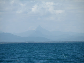
Guanaja

Guanaja isa large (4 mile x 11 mile) island, 90% of which is protected and undeveloped land. Extending beyond Guanaja is a large coral reef encompassing a number of smaller islands with great snorkeling and well protected anchorages. At one of these smaller islands, named Josh's Cay, we were accompanied by a very friendly dolphin that swam circles around our boat. Much to our surprise, he was still there the following day. He was easily identifiable by 3 white scars on the left side of his dorsal fin. He was far from tame, but for some reason had a tendency to stay near our boat. After having him accompany us at 3 separate anchorages, we named him "Tag". As soon as Myra laid her eyes upon Tag, she was in love. We think if she could have, she would have brought him home.

Myra on "Dolphin Watch"

Tag

Steve and Myra were excellent boat guests. They adapted well to the slow pace and simple living, enjoyed relaxing on the boat and swimming in the warm Carribean water. We were soon headed back to Roatan. Our sail westward was beautiful and pleasant with the wind and waves abaft. Oh my, what a difference it makes! To our delight and especially Myra's, we were accompanied by numerour dolphins, playing at our bow. Goodbyes are hard, but soon that time approached us as it always does. The hardest thing about cruising has been missing family, as well as saying goodbye to those friends we've met along the way, simply not knowing when we will meet again, but hoping it will be soon.

Steve adapting to the cruising life
After Steve and Myra left, we went back to Calabash Bight to spend time with Mark and Lori. We enjoyed having time to relax and enjoy their company while waiting for a good weather window to continue eastward and return to Guanaja. With Mark's help, we were able to fix our wind generator. Amazingly we were even able to find the bearings that we needed in Coxen Hole! Our appreciation of their generosity can not be put into words.
From our experience with Steve and Myra, we had learned not to fight the strong easterly trades. We decided to wait for them to ease in intensity or for a northerly front to come in, temporarily shifting the wind direction. On April 24th, the eastern trade winds were light, at 10-15 knots, and we set sail. This time we anchored for one night behind Punta Castillo near the city of Trujillo on mainland Honduras. The following day we sailed to Guanaja. The sailing was extremely pleasant and idealic. One of our favorite things about Chandrika is how easily she sails. Especially when sailing close-hauled (very close towards the direction of the wind), she often sails herself. Even without using an autopilot, we have often let her sail for hours without touching the wheel. Unfortunately, however, she does not sail very close to the wind. We have discovered that this problem is not from her hull design, but rather from her improperly fitted genoa head sail, which is too large and the clew too high for the boat. This sail also presents us with problems in stronger winds (20-30 knots of apparent wind), as we do not have an appropriately sized working jib.
We arrived in Guanaja on April 25th and spent the next few days relaxing, hiking in the mountains on the island, and visiting our dear friend Tag. April 2008

From Guatemala to Honduras

One of the final highlights of Guatemala was Finca Paraiso. With our friend, Jesse, from Xela, himself a wandering tourist, we got to experience the cool pools and hot waterfalls (heated by the hotspring above). Not fully mixed, the water ranged in temperature from approximately 70 to 160 degrees F. Below were underwater caves stretching 20 to 80 feet back which we explored, as well as some aboce water caves still heated by the thermals and inhabited by a slightly unnerving number of bats (100s maybe 1000s). Jesse joined us for an overnight stay and motor/sail out the Rio Dulce, as we began our departure from Guatemala. Check out went smooth and we were soon out to sea once more. Our destination was Roatan in the Bay Islands of Honduras, which lay some 120 nautical miles eastward. The trade winds in this region blow straight out of the east and are customarily 20-30 knots (23-35 mph). We were not looking forward to tacking our way back and forth with our bow crashing into oncoming swell, but had the morale to do so. Luckily this morale never needed to be tested as the forcasted light easterly winds turned out to be light westerlies. Initially the winds were far too light (so light they were practically nonexistent) as we slowly bobbed around with the current carrying us towards Roatan. Worthy of mention, during our patience-testing drift eastward (moving at a speed of 1 knot) were two 4-5 foot long fish (no fisherman's exageration) that swam behind our boat seeking shade under her hull. We tried every lure and bait we had available but to no avail. In desperation, Graham leaned over Chandrika's stern (with Sue holding on to his leg) trying a speargun / gaff hook combination. The plan failed when the spear (shot point blank) ricocheted off the fish's skull, leaving no time for a quick gaff.
after a brief squall
The westerlies soon increased to a beautiful 5-10 knots abaft (from behind) and we were on our way. Overall we had excellent weather with the exception of one light squall. Towards the end of our voyage, the wind eventually shifted to the east, but they stayed light allowing for slow but comfortable sailing. We arrived in Coxen Hole, Roatan on March 24th (3 days and 2 night after leaving Guatemala). March 2008

Climbing in Cerro Quemado

Our second journey to inland Guatemala brought us to Cerro Quemado (meaning "Burnt Hill"), an outcropping of volcanic rock located just outside Guatemala's second largest city, Quetzaltenango (aka Xela). We were eager to do some rock climbing, since we had not done any climbing for five months, since climbing in the gym in Miami. The climbs at Cerro Quemado vary in length from 50 to 150 feet and vary in difficulty from 5.8 to 5.13, with most routes being in the 5.11 range. Most of the routes are fairly steep and technical sport climbs. It was wonderful to move over stone again, and we were pleasantly surprised by how natural it felt.

Cerro Quemado

climbing at last

Cerro Quemado is the most unique and strange place we have ever climbed, or have ever visited for that matter. Hundreds of fundamentalist evangelical pilgrims arrive each day from all over Guatemala and even from other countries in Central America to pray, to soak in the spiritual aura of the mountainous, rocky peak, and to speak directly to their god. Graham refers to their experience as "spiritual brainwashing." The vast majority of Central Americans consider themselves either Catholic, Evangelical, or one of the numerous indigenous American religions. However we have noticed the lack of definite borders between these religious denominations and have observed a vast spectrum of different religions resulting from the fusion of western Christianity, Mayan tradition and local beliefs.

While at Cerro Quemado, we observed Mayans in traditional dress carrying colorful bouquets of flowers and more modernly dressed mestizos lugging five foot tall speakers on their backs up the steep trail in order to blast various Christian songs while they sang and prayed. From before dawn until after dusk, the air was filled with the sounds of people chanting, moaning, wailing, and screaming in a disharmonious mix, combined with singing and upbeat, almost mariachi-sounding disco music. The voices and music came from around thirty or forty small outcroppings throughout the mountaintop, as different groups prayed in separate locations in either Spanish or one of the twenty different Mayan languages found in Guatemala. Moving from one area to another, one might hear five to ten of these different groups at any given moment. There was virtually no stop to these sounds, which resonated through the mountainside. It varied from day to day; although, typically it was only quiet from about 2am to 5am. One morning, however, we were awoken at 3am to the screaming voices of our neighbors, who were camping under a palapa (an open thatched or sometimes tin-roofed shade structure). One of our neighbors was performing an exorcism on his friend.

arriving at Cerro Quemado

mucha musica

chanting

jamming in prayer

All of those who we met and with whom we spoke were incredible friendly and kind. Their time praying and being in the beauty of this mystical landscape, with clouds rolling down its jagged peaks and spilling into the valley below, gave these people a sense of elation and happiness which was contagious amongst themselves and to us. Knowing the importance and sanctity of this place to these people, along with our witness of the enormous amount of trash thrown everywhere by these people, confirms that this culture lacks even the slightest environmental awareness. For example, they would leave beautiful flower arrangements, as an offering to their god, in cut-off non-biodegradable 2 liter Pepsi bottles. During the four days and three nights we stayed at Cerro Quemado, we were entertained by the behaviors and customs of these people and in turn we served as entertainment for them. It was not uncommon while we were climbing to turn around and see a small group of onlookers gathering at the base of our climb, watching us. Looking down at groups further away, we noted that we were often distracting them from their prayers. On one occassion, we asked a small group of Guatemalans if they would like to try climbing. Two of them accepted, a young highschool aged boy and an evangelical pastor in his early thirties, dressed in his Sunday best. The pastor was a natural, while the young teen appearing equally fit, struggled on the opening moves. With little interest beyond getting high on the cliff face, the teen climbed up the rope until his fear got the better of him. They were very appreciative of the opportunity, and as we go our separate ways, both us and them walk a little more culturally aware than before.

The summit marker that appeared during our stay. Was this intended for us? Or just for Americans in general?

March 2008

The Cays and Reefs of Belize

Fishermen outside of Belize City
Dolphins swimming beside Chandrika under sail
It was due time for deeper exploration into Belize's islands and surrounding coral reefs. Our first stop after leaving Placencia was Lark Cay. While rowing to a coral reef next to a nearby island, we were called ashore by the locals who lived there. This unnamed island held a population of 3 and 1/2. The island was apparently owned by an American, who had hired Clayton to work the land, clearing and filling with plans to develop it into a tourist retreat. Accompanying Clayton was his 17 year old pregnant (hence the half person) wife, Shamra, and their little 1-1/2 year old daughter, Kilanie. They invited us over for a delicious lunch of rice, beans and fried fish, the typical local cuisine. It was pleasant to receive such open hospitality by the locals rather than being seen as either a source of income or a nuisance, the common view of foreign tourists.
A half days sail north was Crawl Cay where we met up with our friend, Doug, on Serendipity, who we had met in Placencia. Doug introduced us to the art and practice of spearfishing. Sue caught us dinner and was hooked on the sport. Graham with his catch of Grouper
We were tracking our way north with plans to renew our visas in Dangriga (having been in Belize for almost 30 days) on our way to Belize City to meet up with Graham's mom, Chrissy, and his Uncle Chuck (aka Uncle Fun). Dangriga, however, was found to be an open roadstead, meaning that its coastline was exposed to the prevailing winds and built up seas. A dangerous row ashore combined with strong easterly trades and an expiring visa, left us with no other choice than to continue sailing to Belize City.
A few days later on January 23rd, we picked up Chrissy and Chuck at the airport in Belize City. Chrissy and Chuck were to be our first overnight guests. Their new experience with life at sea would begin gently with a short and easy motor ride to Robinson Island, where we spent the night at a calm anchorage. The following morning, we sailed with pleasant 10-15 knot NE winds under full canvas (with all sails up) to Colson Cay. We spent the afternoon and the whole next day snorkelling, spearfishing, spending time together, and playing lots of bridge.
The rhythm of cruising is generally slow and highly reflective of the wind, waves and weather. Some people make plans more than others on a boat, as on land, but on a boat sticking to plans is ignorant and sometimes dangerous. Learning to pay attention to the elements and dance with them and not even saying "We'll go to Tobacco Cay tomorrow," was an attitude very contradictory to the American land-based life that Chrissy and Chuck were used to. We had been on the boat for a few days and had worked our way south to Tobacco Cay. Chrissy and Chuck had adapted well to the boat but were ready to step ashore and stretch out the legs.
Chrissy and Chuck adapting to "Boat Life"
Tobacco Cay sits on the barrier reef yielding beautiful views of crashing waves, transitioning the seas from 10 feet to 2 feet or less. We enjoyed good eats and snorkeling here and prepared for our return trip to Belize City. Our trip was filled with laughs and good times and good conversation. It was nice to share this lifestyle with family. We also enjoyed educating them and making them a little saltier. The love for family is a void which can never be filled and as we travel the seas, these visits are priceless.
Dropping sail at sunset
January 2008

Rio Dulce, Guatemala and El Mirador

Upon entering Guatemala, we checked in with customs and immigration in Livingston. We gave the officials hoards of money for them to stuff in their personal wallets, as is typical of these beaurocratic systems we call governments. We stayed in Livingston for the night and in the morning motored 25 miles up the river, known as the Rio Dulce (meaning Sweet River in spanish). The river narrowed as we entered into a steep walled gorge with a few exposed limestone cliffs. The river was full of Guatemalan men and boys paddling canoes while fishing.

The Rio Dulce in Guatemala

We moored the boat (and are now docked) at a marina near the town of Fronteras. The marina provided us with a safe place to leave the boat, allowing us to explore inland. We decided to visit El Mirador, the first Mayan city ever to be constructed, which holds numerous magnificent temples including the largest ever to have been built (235 feet tall). The ruins of El Mirador date from the early PreClassic period (1500 - 1000BC) but most are from the late PreClassic period when the city flourished (150BC to 150AD). These ruins were not rediscovered until 1926 and very few people have even heard of El Mirador, including the Guatemalans themselves. Fewer still ever visit the ruins due to their remote location.
In the afternoon on Wednesday, March 27th, we took a bus from Fronteras heading north to Santa Elena (outside of Flores). We spent the night in a disgusting hotel in Santa Elena. In the morning we caught a micro (a small bus) to San Andres. On the micro, we met the father of a Guatemalan archeologist. We met the archeologist in San Andres and told him of our desire to find the ruins of El Mirador without a guide. He placed a call to Carmelita, the small town where the trail begins, and spoke with the local who has assisted the archeologists with their work for the last 30 years. From San Andres, we began hitch hiking north on the dirt road to Carmelita. Due to the color of our skin, it was difficult to get a ride. We started walking. Our first hitch was only a few kilometers in which we stood on the back bumper of a pickup truck to the edge of town. Our second hitch was more fruitful, bringing us 30km closer to Carmelita. We rode in the back of a pickup truck with one other hitchhiker, and we picked up a couple more en route. The truck stopped in a small village with a school right beside the road. It being Guatemala, where the school children seem to always be on recess, the place was swarming with kids. Moments later there were forty small children staring at us with large, open eyes of curiosity. They seemed to be fascinated by anything and everything about us. We needed to find something to break the ice and to make them laugh. Sue had the idea of taking a blade of grass, placing it between the first and second joints of both thumbs, and making a whistle that sounds more like a dying duck. Graham was soon making all sorts of loud, funny sounds, and the children were bursting with laughter. They were continually staring at both of us with fascination as we kept making these strange noises. To further the entertainment, Graham started to dance to the tunes, and the children erupted in giggles. Sue asked in Spanish, "May I take your photograph?" They didn't really respond, so Sue whipped out her camera. Immediately, about thirty-five kids turned on their heels, and ran away at full speed, screaming as they went. We hung out and played with the ones who remained and the few who returned, while we waited for cars to pass by this deserted road, as we hoped to find another ride.

School children during their full day "recess"

A logging truck was parked nearby. They spent about 2 hours fixing the breaks; afterwhich, the driver offered us a ride. We road another 10km to the next village in the front cab of the semi. In the next village, we sat and cooked a lunch of peanut curry pasta before catching our fourth and final ride in the back of a pickup truck that took us the remaining 20km to Carmelita. We were dropped off in the center of Carmelita in front of a guide agency offering guided trips with mules to El Mirador. We tried asking directions to the trailhead but quickly realized that it was as fruitless as asking directions from a cab driver, whose sole objective is to make business. The guide agency discouraged us from trying to go on our own and told us we would get lost. However, we still refused their services, as it cost more money than we had brought with us, but more importantly it went against our style and prefered method of travel. The gentleman, Brijido Perez, in Carmelita who had received a phone call from the archeologist was awaiting our arrival. He saw us at the guide agency and came over to introduce himself. He suggested that we go to his place and spend the night. Once at his place, we discussed with him the logistics of hiking in alone. The entire trail to El Mirador is about 60km and passes by many other ruins, including two former Mayan settlements, called La Florida and El Tintal. He agreed that we would be able to follow the trail on our own, but suggested that we hire a local to show us the way to La Florida (about 10km) as the trail had numerous branches. From there we would hike on our own. He introduced us to his friend, Jose Luis, who agreed to walk us to La Florida in the morning.

Graham, Sue and Brijido

At 6am on Friday, March 29th, we met Jose Luis and began our hike. The trail to El Mirador was fairly flat with only a few hills. The difficulty lay in the condition of the trail. It was filled with numerous, deep mule tracks formed in the wet season. It now being the dry season, the broken up ground had hardened and provided very difficult and painful walking. By the end of the trail, it felt as if someone had taken a meat tenderizer and had repeatedly pounded it on the underside of our feet.

following the mule tracks

The tropical forest through which we walked was filled with plants and wildlife. Most of the locals in the area, including our guide, Jose Luis, earn their living by collecting the green, leafy fronds of the xate plant, which is exported to the US and Europe for the greenery in flower arrangements. None of the xate collectors we met knew what the plant was used for, and the man who purched it from them either refused to tell them its use or did not know himself. The xate collectors earn about 25 cents for collecting 70 fronds, which must be in perfect condition. Many xate collectors also harvest the sap of the sapodilla tree, which is used to produce chicle, an ingredient in chewing gum.

Upon reaching La Florida, we said goodbye to Jose Luis. We met the vigilantes, or caretakers, that watched over the ruins of La Florida, protecting them from looting. To our surprise, we learned it is also part of their job to ensure that hikers do not get lost in the forest. A vigilante, named Jesus, decided to accompany us on the next leg of the trip (about 14km) to El Tintal. We reached El Tintal in the early afternoon, which gave us time to rest and to explore its ruins. The ruins of El Tintal have not yet been excavated, so we mostly looked at mounds of earth covered with trees and other foliage. However, we did see many trenches dug by looters into the sides of numerous tombs. We also hiked to the top of the main pyramid and from there we could see El Mirador in the distance.

We hung out with the vigilantes at El Tintal, who provided us with rain water to drink, and we spent the night in our tent under a thatched roof structure. Jesus asked us if we would like him to accompany us to El Mirador, but we declined his kind offer. In the morning, we set off alone to El Mirador. We were given general directions to stay to the right if we came to an intersection; although, on two occassions our instincts told us to stay left, which turned out to be the correct route. Most of the trail followed an old Mayan road, which due to the thick vegetation and overlying dirt was difficult to notice. The road bed rose up about four feet high and was approximately fifty to sixty feet wide. After about 8 hours of hiking, we reached the entrance to the National Park in which El Mirador is located. It was here that we saw our first excavated Mayan ruins, which dated to the early preClassic period. These ruins, known as El Grupo La Muerta (aka the Death Group), consisted of a pyramid temple beside a former stone residence. We were able to crawl inside the residence and see the interior sleeping quarters.

the residence of El Grupo La Muerta

We then continued on to El Mirador, which was another 45 minutes of walking. Upon reaching El Mirador, our feet were aching and we decided to spend the rest of the day resting and eating. While we were eating, we met the chief archeologist, who instead of giving up interesting archeological information, decided to express his conservative, living in fear attitude and hence his disapproval of our walking in without a guide. He was busy and had to be on his way, but we couldn't help wondering if his helicopter ride was really safer. We spent the next two days exploring the ruins of El Mirador. The Mayans were an advanced society of the time with a good understanding of astronomy and time. The Danta pyramid (on the east side of El Mirador) is positioned so that from El Tigre pyramid (on the west side) on will witness the sunrise over its central summit on the equinox and over its secondary north and south summits on the winter and summer solstices, respectively. They lived off the land (both naturally and agriculturally). They were also masters of stone from creating great temples of limestone to knives of obsidian and carvings of jade (both of which were imported). One of the biggest questions yet to be answered is why they buried the entire city under a few feet of rock and earth. This required huge amounts of energy and eventually resulted in the city becoming overgrown with jungle. It makes one think that it was perhaps an evacuation planned years in advance. Also no one knows why they left.

Map of El Mirador

Part of the thrill and experience of seeing El Mirador lies in the beauty of its natural surroundings. El Mirador is situated within the center of the largest tropical forest in all of Central America. It is so remote that, since the evacuation of the Mayans, it has been virtually untouched by mankind. The forest is filled with wildlife. Neither of us had ever seen so many monkeys. They were everywhere. We saw spider monkeys, which travel in large groups and are extremely quick, agile and always moving about, crashing around in the trees up above. We also saw howler monkeys, which are named after the loud growling sounds they make. We were warned not to stand directly below them, because the mischievious howler monkeys will throw sticks at you and try to pee on you. We also saw numerous birds, including a pair of toucans, as well as spiders and snakes. We also saw a few coatis up in the trees. These strange animals look like a cross between a fox and a racoon. Unfortunately, despite the wildness of the forest, it is threatened on its outskirts by illegal logging, slash and burn agriculture techniques and poaching. In the last 10 year, both spider and howler monkey populations have declined by 20%. We hope that recent efforts by the Guatemalan government will help to preserve and protect this amazing area.

Un Mico (A Spider Monkey)

Un Saraguate (A Howler Monkey)

A Loco Arriba Monkey

Unfortunately some of the wildlife we encountered on the journey was not so pleasurable. The forest is also filled with near microscopic-sized ticks. Graham unknowingly sat in a nest of them while wearing shorts. The next morning Graham had about 150 to 200 of these tiny creatures clinging to his body. We won't go into the details but they were in some of the worst places imaginable. Fortunately, the ticks in Guatemala do not carry diseases, as deer ticks in the US do. After two days exploring El Mirador, it was time to head out. We spent one long day hiking from El Mirador to La Florida, where we camped for the night. Along the way, vigilantes had been supplying us with rain water to drink. To our dismay, we discovered that the vigilantes in La Florida did not collect rain water but instead drank from a manky swamp. The hue of the swamp water would remind one of an expensive powdered greens drink one might find at a health foods store. But...it was not. It was swamp water, and we drank it (after bleaching it for 30 minutes and boiling it, of course!) The return home was uneventful, except for our micro ride, during which the driver had to stop ever 5 minutes to reinflate the front tire with a bicycle pump.

Our swampy drinking water

All in all the trip was not for the faint of heart. The reward was a great insight into the Mayan way of life. March 2008

Rubber Legs Not Lubber Legs

As we ventured further south in Belize, the landscape of mainland became more and more mountainous. Victoria Peak, a 3675 ft (1120 m) peak, rising sharply with its prominent summit jutting out high above the surrounding mountains, immediately caught our eye. Not having climbed, or much less even seen, a mountain for may months, we became fixated on climbing it.

Victoria Peak

Due to Belize’s geography and weather patterns mainland access is quite difficult by boat. The winds at this time of year come predominantly out of the north and the east. Most of Belize’s coastline lies exposed to these wind directions. Even though the large barrier reef to the east shields the mainland from most of the ocean swell, during periods of moderate or high winds the coast can still be exposed to rolling waves. (The barrier reef lies several miles to the east of the mainland coast, allowing several miles for swells to build up and develop.) We needed to find somewhere protected from swells and from theft, where we could safely leave the boat on anchor for a few days. After spending a number of days in Placencia, we discovered we had found such a place. We had met an excellent and supportive community of cruising sailors and found a couple that agreed to keep an eye on our boat and on Squeak for us for a few days. We also decided to leave immediately after a norther had passed through, maximizing our chances of calm weather before the next norther decided to rear its ugly head. We did not feel comfortable leaving the boat and Squeak for more than 3 days (2 nights), so we would have to travel fast and light. Victoria Peak lies in the Cockscomb Basin Jaguar Preserve. To access the park, we needed to take a bus from Placencia to a town called Maya Centre. From there the park entrance lies 10 km by highly eroded dirt road. Being too cheap to pay for a taxi and not having the time to walk, we decided to bike into the park. We had only one bike aboard Chandrika, but were able to buy a beat up old mountain bike in Placencia, so we now each have one to ride. We were ready to begin our attempt at Victoria Peak. We awoke at 3:30 in the morning. After eating breakfast, we piled both bikes, two large backpacks filled with camping equipment and provisions and ourselves into our 8 foot plastic rowing dinghy (with a rated 450 lb maximum weight capacity) in the dark. It was a bit of a delicate balancing act, but we arrived at the dinghy dock with all of our supplies in one trip. We left our dinghy at the fuel dock. Our friends, Susan and Gary on Pacifico would be borrowing and looking after our dinghy while we were gone. Their dinghy and outboard engine had been stolen from behind their boat one night while at anchor in Placencia. We caught our 5:30 am bus to Maya Centre, which ended up leaving at 6am. We were able to take our bikes on the bus without any trouble. After arriving in Maya Centre at 7:30, we hopped on our bikes and began the journey into the park. The bike riding was absolutely exhilarating! The dirt road was quite rocky and full of potholes and other obstacles. It also would rise steeply and then drop down quickly, allowing for some very exciting and adventurous mountain biking. It was made all the more thrilling for Graham, who rode the second hand bike we purchased in Placencia. It only had one gear and it had pedal breaks, only allowing him to break with the rear tire. The large backpacks only added to the challenge. Halfway through our 10 km bike ride, it began to pour. There is a reason the forest here is called rainforest. We very quickly became completely drenched. The rain had permeated through our Gortex rain-gear. But...at least it wasn’t hot! Despite the weather, we enjoyed the lush sounds of the forest with its beautiful bird song melodies. When we arrived in the park at the Victoria Peak trailhead, we hid the bikes behind some thick vegetation and locked them to a vine. We began hiking. It was still raining, but since we could not get any wetter, it really did not make much difference. The first 12 km of the trail was gentle and pleasant hiking, which led us through thick luscious forest full of tropical plants and birds. We only saw one group of 3 hikers on their way out of the park. Otherwise we would see no other people during our hike. The rain made the trail very muddy and slick, but since it was fairly flat walking, it was not much of a hindrance. After hiking 12 km, we arrived at Camp 1, which had a simple thatched roof structure (with no walls) and an adjacent pit toilet. Having only 3 days, we decided to push on towards Camp 2, the site of another thatched roof structure located at km 19.

jungle ferns

Camouflaged Evolution

Soon after leaving Camp 1, the trail began to rise and fall more steeply. By km 15, the elevation changes were becoming increasingly steep and exhausting. Hiking uphill, we would have to grasp onto tree limbs and vines to prevent ourselves from sliding down the wet and muddy slope. As soon as we arrived at the top of the incline, we would look down at an equally steep and slippery descent. We climbed in all about 10 of these hills only to descend to the same elevation at which we’d started. Furthermore, the signposts that marked each kilometer were getting further and further apart. We realized that this was not due to our fatigue, but due to the fact that the signposts marked kilometers according to their GPS position. It was one kilometer “as the crow flies” between signposts, even though the trail took numerous bends and undulations. It took us longer to hike the last 7 km between camps as it took to hike the first 12 km. We arrived at Camp 2 at 17:30 completely exhausted. We had been biking and hiking for 10 hours. Because of the wet and soggy shoes, Sue’s toes were covered in numerous painful blisters. From all of the steep ups and downs, her knees were throbbing. A few days later, Sue’s big toenails would turn bright purple and almost fall off. With the lack of use on the boat, our legs had turned to rubber unlike those of a landlubber. We made dinner and set up camp. Because of the presence of the thatched roof huts at each camp, we did not bring a tent for shelter, but instead hung mosquito netting, which we slept underneath.

Waterfall at Camp 2
We awoke at dawn. Our original plan had been to hike to the summit of Victoria Peak and then descend back to Camp 2 on our 2nd day. On our 3rd day, we had planned to retrace our steps, hiking out the “19” km and biking back out to Maya Centre. We had only brought food for 3 days and the cruisers watching our boat were expecting us back on Day 3. We were unsure of the total distance we still had to hike to reach the summit of Victoria Peak; however, we knew that it would be a very steep ascent involving a climb up a fixed rope through a narrow and wet gully. The entire rest of the route would follow a soggy vertical creek bed. Due to the extremely wet conditions of the day prior, we were unsure if the ascent would be dry enough to be passable. The rain had lifted during the night and we had awoken to a clear sky, improving our chances. Over the years, we both have learned to listed to our bodies, and this was one of the rare occasions where we did not ignore what our bodies were telling us. It is after all about each footstep and the pleasure of the journey and not the achievement of the summit. We spent the hiking back to Camp 1, where we spent the night. On our 3rd day, we hiked back towards the park entrance and our bikes. As we got closer to the trailhead, we began to see more and more human footprints. Among those were prints that appeared to be of a hoofed animal, or so we thought. As we walked, the prints became more legible, and they looked more like those of a large dog. We found our bikes, and while we were unlocking them, we heard a strange noise that sent shivers down our spines and froze us in our tracks. It could be nothing other than the sound of a very large and angry cat. The only cat in the park large enough to make such a deep and ferocious sound is the jaguar. You could literally hear the cat breathing. As the cat exhaled, it sounded like a roar and with every inhalation was a deep purr. We could see no further than a few feet into the thick jungle, but the cat sounded as if it were within a hundred feet of us. To avoid being seen as a fleeing target, we walked the bikes instead of riding them. Eventually we noticed that the roars and purrs overlapped. We kept walking and then there was a dead eerie silence. Even the birds of the jungle had gone silent. Now we were scared, so we just walked...quietly. When we arrived at the park headquarters, we saw the ranger. He confirmed that the sounds we’d heard were those of two jaguars meeting, exhibiting a characteristic competition for dominance. We asked the ranger if jaguars and dangerous to people. He answered, “Typically no, but when meeting they can be.” We hopped on our bikes and headed out on the dirt road towards Maya Centre, where we caught a bus back to Placencia. January 2008

Isla Mujeres to Belize

After being in Isla Mujeres for about a week, we were growing weary of the weather. We experienced strong winds (often up to 40 knots) both from the SW and more commonly from the N. Strong winds from the north, called northers, are common in this area during the winter months. These northers begin in December and grow in intensity and become more frequent in January and February. They can reach 80 knots later in the winter. Because the Gulf Stream current in this region runs from south to north, these northerly winds run opposite to the flow of the Gulf Stream, resulting in large seas, which are rough and disorganized. We were eager to leave Isla Mujeres and head further south where the northers are much less intense and where the northbound current is weaker. We decided to skip the rest of Mexico and head straight to Belize, which is surrounded by the world’s second largest barrier reef. This reef runs almost the full length of the country and protects the eastern coast from ocean swells. In order to sail to Belize, we would have to keep an eye on the weather and try to depart after a norther, which would provide us with a window of good weather before the following norther. Another reason for wanting to leave Isla Mujeres was the poor holding ground around the island. There is only a thin layer of weed covered sand above a dense layer of hardened coral, so our anchor was not able to penetrate very deeply. After watching numerous boats drag anchor and start drifting off, it was finally our turn. On the night of December 14th after going to bed, the winds began to grow in strength. It was difficult to sleep. I (Sue) awoke at least 10 times during the night. Everytime I awoke I would look out and check the GPS to make sure we weren’t dragging. I’d also go on deck and check the tension on the anchor line. It seemed that every time I checked, the wind was coming from a different direction in varying intensities from 20 to 40 knots. At 5am, we were awoken by our anchor alarm on the GPS, telling us that our boat had moved significantly from its original position. We looked outside and saw that the boat was moving rapidly unimpeded towards a concrete wall. We jumped out of bed, ran out on deck, started the engine and hoisted the anchor. We decided we would reanchor in a lagoon, called Laguna Makoy, inside Isla Mujeres that we had learned about a couple of days prior. The holding ground is only marginally better, but the area is nestled behind a patch of mangroves which shield some of the wind. Because it was still dark and visibility was poor, we decided to motor around in circles until sunrise. At first light, we squeezed through the opening into the lagoon and set anchor. Inside the lagoon, the winds were about 10 knots lighter. Soon many other boats decided to join us and the lagoon rapidly became crowded with boats. Despite being in a more protected area, we were uncomfortable being in such tight quarters. For the next couple of days, we waited out the ensuing norther. We were not comfortable leaving the boat unattended, so we mostly entertained ourselves by reading, playing cribbage and backgammon, and when the winds would lessen a bit, visiting our friends, Mark and Lori, aboard neighboring Aeolus. We decided we would leave for Belize after this norther, so Sue visited the port captain, where we officially cleared out of Mexico. Weather forcasts we heard from other cruisers predicted that the norther would subside on December 18th, and would soon be followed by 10-15 knot easterly trade winds. On December 18th, the winds had lessened a little, and we set sail for Belize at 4:45am. We were sailing under full main and staysail in 15-20 knot NE winds, occasionally gusting to 25 knots. The seas were choppy until we rounded the southern tip of Isla Mujeres, where we met the ocean swell. The seas were now 6 to 8 feet and very rough and disorganized. As we rounded Punta Cancun, we got hit broadside by a large swell that sent our 5 gallon water jugs flying across the aft cabin down below. A locker (cabinet) door also flew open, sending pieces of wood and other items all over the main salon. We were sailing quickly from 5-1/2 to 7 knots until we hit the strong northbound current of the Gulf Stream as we squeezed in between Isla Cozumel and mainland Mexico. The current slowed us to 1-1/2 to 2 knots. Not wanting to spend the next 24 hours fighting current and getting slammed around by the waves, we decided to turn on the engine and motor-sail until we exited the current. After dark, the winds were still coming from the NE at 15 to 20 knots with 25 to 30 knot gusts. No longer fighting current, we were now sailing along at 5-1/2 to 6 knots. We were eager to feel the predicted 10 to 15 knot easterly trade winds, which would calm the seas significantly. Although the seas were rough and the winds strong, we were not concerned for our safety, but we were very uncomfortable and growing sea sick due to the strong quartering seas. Graham had the pleasure of making dinner and when he came back on deck had a pale green complexion. The sea conditions made it impossible to sleep, which aggravated Graham’s condition. Squeak was also feeling ill. I had tried giving him Bonine for motion sickness, but did not do so early enough and he was unable to keep it down. The wind and seas did not finally subside for another 24 hours. The beautiful 10 to 15 knot easterly trade winds that had been predicted for most of our passage were only experienced for one hour during the night of the 19th. They were soon followed again by 15 to 20 knot NE winds. The brief change in wind direction, however, had managed to calm the seas a little, and we were both able to finally get some sleep. To sleep we would lie down on the cabin sole (floor) in the center of the boat, and smoosh our body in one place by wedging it in between cushions and pillows, like a canned sardine. The winds and seas lessened steadily throughout the evening and on the morning of December 20th, the winds stopped. The seas were flat and calm. We took turns sleeping heavily for the rest of the passage. Soon the winds picked up at a gentle 10 to 15 knots out of the west and we were able to sail at a beam reach until we reached the Eastern Channel entrance through the barrier reef leading to Belize City. We had made good time on our passage, having gone about 90 nautical miles the first 24 hours and approximately 130 nautical miles the second 24 hours. We anchored at 1pm on the 20th behind a beautiful island at Robinson Point. We decided to eat and rest and check into Belize City the following day. Clearing into Belize went fairly smoothly once we were able to contact the officials, who do not monitor the VHF radio. We ran some errands in the city and then left to explore more remote parts of the country. Since entering Belize, we have done a lot of snorkeling. Many of the reefs here are alive and thriving; although some of them are on their way out. While snorkeling we have observed many strange and indescribable organisms. We have no idea what many of them are and would love to learn more about coral reef biology. We saw two strange bright orange and yellow polk-a-dotted blobs that appeared to be parasitizing the coral. We have also observed an organism that looks like an underwater Venus flytrap. We you approach them they vanish in a blink of an eye into a tiny little hole. We have also seen sparkly little cones that look much like Christmas trees, which display a similar disappearing behavior. We also saw a manatee about 10 feet from our rowboat. It was quite shy and did not stick around for us to observe it. While sailing and at anchor, we have seen numerous dolphins and a couple of whales. The dolphins love to race alongside and in front of Chandrika while she is under sail. It is such a rush to sit on Chandrika’s bow, dangling your legs off the front and watching the dolphins surface only feet away. I don’t think I will ever grow tired of watching them. After having done so much snorkeling, we are now excited to spend some time on land. The islands here are almost entirely mangroves, so are not conducive to exploration. We would like to visit the mountains and rainforests on mainland Belize. We are currently anchored near Placencia, a small touristy town on the mainland waiting out the first norther we’ve experienced in Belize. The winds here are from the north and northwest mostly around 25 knots, with frequent 35 knot gusts and the occasional 40 knot gust. Again we have seen many of the neighboring charter boats drag, but so far are holding steady. While we were down below playing backgammon, we heard the faint sound of a fog horn. We ran up on deck to see a 45 foot 33,000 pound steel sailboat 20 feet away being blown straight towards our bow. We quickly grabbed inflatable fenders to try and cushion the upcoming blow. We were extremely fortunate as their boat grazed our bow with only 6 inches to spare. The outboard motor for their dingy, which was mounted on the stern of their boat, smashed into our front navigation light, shattering it. However, had they been 6 inches further aft, they would have done serious damage to our bow. Apparently they had just laid down their anchor when it began to drag. At that moment, their inboard motor died on them, so they had no way to control their boat. After securing their boat, the captain kindly came by to visit and to reimburse us for our broken running light. This incident has reinforced our extreme dislike of being in a crowded anchorage during a norther. Not only do we need to worry about our boat dragging and hitting other boats, but we need to worry about other boats as well. This event also reinforced our desire to purchase a Single-Side Band (SSB) radio. We have been relying upon other cruisers who have SSB to provide us with weather forcasts. When we were out exploring the reefs, we did not meet any other cruisers (or for that matter any other people) and did not have access to weather predictions. We are hoping to buy an SSB high frequency radio that will give us this access, but we will probably have to wait until we get to Honduras before we can purchase one. We plan to stay in Belize until the end of January. We can hardly wait to see Graham’s mom and his Uncle Chucky (aka “Uncle Fun”) when they come to visit us on the 23rd. After their visit at the end of January, we plan to sail southward to the Rio Dulce of Guatemala. After the Rio Dulce, we will travel to Honduras, where we will visit some friends in Roatan. January 2nd, 2007